Saturday, June 1, 2013

The Road Home on Hwy 61-part 11 of Natchez Trace Parkway Series

For our trip back home, we decided to take Hwy 61 up from Natchez.  This is the "scenic" route but to the honest, its not all that scenic unless you think shacks and miles of cornfields are scenic.  Since I live in a rural area, I am used to seeing shacks and row crop fields all the time.  But, Hwy 61 is a part of the Mississippi Blues Trail and if you are a fan of the Delta Blues you may think you have struck gold.  For more information on the The Mississippi Blues Trail see:
http://msbluestrail.org/     Also, you may wish to read this article in the National Geographic about Hwy 61:  http://travel.nationalgeographic.com/travel/road-trips/blues-highway-road-trip/


One of the big highlights for me was finding The Onward Store.  We had already passed Vicksburg and were starting to get hungry and in need of restroom facilities.  With no prospects for miles (and miles), I was wondering if I was going to have to get Rick to pull over in a cornfield.  In the middle of nowhere, like an oasis in the desert, we came across a store called "The Onward Store".
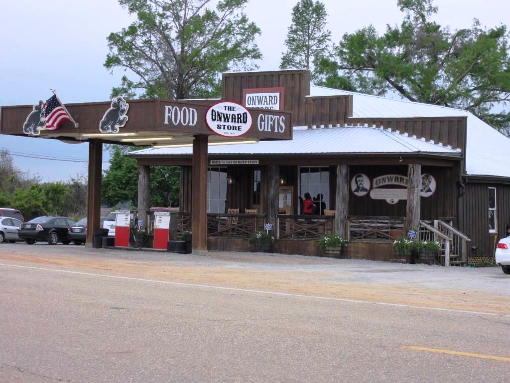
This place could almost be a destination in itself.  The front was an actual store with snacks, sodas, beer and gifts while the back is a restaurant.  There is a deck on the back with patio furniture and the waiter said they are trying to get live bands.  The food, wait staff, and atmosphere were great.  

If you ever find yourself in Rolling Fork, MS, I recommend that you pay The Onward Store a visit.


Friday, May 31, 2013

Natchez State Park - Part 10 of Natchez Trace Parkway Series

Natchez State Park in MS (not to be confused with Natchez Trace State Park in TN) is a few miles north of the south terminus of Natchez Trace Parkway.  We generally like camping in state parks and decided to stay here a couple of nights before we made the long journey back home.  Even though we had a good time at Natchez, I must say this campground is probably my least favorite of the places we have camped.

The main reason for my dislike is the close spacing of the campsites and no privacy at most of them.  With our slides out, I felt like we
were encroaching on our neighbors picnic area.  The only redeeming thing about this site is the open space behind our campsite which allowed for bank fishing.  The site was not very deep and did not allow for parking our truck in front of the fifth wheel unless we angled it in.  This was site #37 in campground loop B.  Loop A had no access to the lake.  I could not find any pictures online before we reserved this campground and I thought these sites backed up to the lake and would have good access for
fishing.  However, there was so much brush and woods that only a few feet were accessible.  With the negative out of the way, I will say that my husband caught a few nice size fish (bream and catfish).  This site was $18 per night for water/elec.  There is a dump station and a nice bathhouse with a washer/dryer.

While we were at Natchez, we decided to have a look around this historic town and we found a "plantation" that is a part of the
National Park Service.  It is called Melrose and was built in the late 1840s by a Pennsylvania man,  John McMurran.  He was a lawyer and state legislator.  A tour of the grounds gave a glimpse of how these people lived back in the mid 1800s.  The "main house" was huge and elaborate.  The front faced the garden area while all the other buildings were in the back.
The kitchen was in a separate building, as was the custom to lessen the chance of fire in the main house.  Another building that looked identical to the kitchen was directly across from it.  It housed the dairy and laundry.


There was one well pump next to the laundry, one next to the kitchen and another next to the slave quarters.  


There was also a garage (carriage house) with several period
carriages.


The slave quarters were 2 frame houses quite removed from the rest of the buildings.  I found it peculiar that this plantation was owned by a Pennsylvania man (a Yankee), yet he owned several slaves.  It is my understanding that Melrose was not a crop plantation (like cotton).  The slaves
were mainly for the running of the household, carriage drivers, tending the vegetable garden and fruit orchards.  


One of the most memorable things on our stay in Natchez is the moss hanging on the trees.  I found this to be quite beautiful and eerie at the same time.

We camped at Natchez State Park on Thursday, May 9 and Friday, May 10, 2013.


Thursday, May 30, 2013

Natchez Trace Parkway Series part 9 - Choctaw Lake to Natchez

The drive from Choctaw Lake to Natchez State Park was one of the longest on our journey. At milepost 193, you will come to Jeff Busby campground.  This is one of the 3 free campgrounds on the Trace.  In addition to several camping slips, this area has a self-guided nature trail that takes you to one of Mississippi's highest points at 603 ft.

Close to Jackson, MS we stopped at milepost 105 to view the expansive Ross Barnett Reservoir.


At mile post 55, you will come to Rocky Springs, the southernmost free campground on the trace.  


We stopped at milepost 41 to walk part of the Old Trace called "Sunken Trace".


At milepost 15, we came across the historic site of Mount Locust.  This is a restored historic house, turned into an inn (called a stand).


This was the back of the house, although to me it looks like it
should be the front.


Here is a view of the "back".


An inventory of furnishings, along with the prices of the time was found and can be seen at one of the exhibits.  The house was considered elaborate for its time.


The last stop we made before Natchez was at milepost 5.  This is the site of the Elizabeth Female Academy Site.  It was founded in 1818 and was the first school for women charted by the state of MS.  I never realized that Natchez used to be the capital of MS (not Jackson).  Once the capital moved to Jackson and the population shifted, this school struggled to stay open.  It finally had to close in 1845.  There is still one partial wall that remains.


Wednesday, May 29, 2013

Choctaw Lake Recreation Area Campground-part 8 of Natchez Trace Parkway Series

Choctaw Lake campground is located near Ackerman, MS about 13 miles from the Natchez Trace Parkway.  It is in the U.S. Forest Service Choctaw Lake Recreation Area.


What a gem of a park.  There is a large lake (actually 2 lakes) and  a trail that goes all around the campground and both lakes.  


This park has a small swim beach, a playground, and boat dock.There is also a large day use area with a group pavillion
that would be great for parties or family reunions.

We arrived on a Wednesday and there was no one else camping there except the camp host.  He said that Thursday afternoons the bottom loop (lakeside) starts to fill up.  All of the bottom loop sites (2-11) are walk-up, first come first serve only.  The upper loop sites are a bit on the small side.  The campground has 1 bathhouse which is adequate but is dimly lit and could stand a good cleaning.  

We pulled into site #9, a very spacious site, well shaded with the living area facing the water.  The site was a straight back-in. The only problem we had was the site was not level side-to-side, but the view and serenity made up for any inconvenience.  The bull frogs gave us a serenade at night.


I really wish we had more time to spend at this campground as we only got to stay one night.  I would love to go back; however, the first-come, first-serve policy on the prime spots will discourage us from using this as a weekend camping spot.  I am guessing these spots are gobbled up by people who live nearby.  I believe this campground closes sometime in December and reopens in March.  We camped here on Wednesday, May 8, 2013.

We really enjoyed this park and hated to leave so early.  This picture just about says it all:


Davis Lake to Choctaw Lake -part 7 of Natchez Trace Parkway Series

Once we left Davis Lake at milepost 243, we only had to travel about 50 miles to our next destination.  To reach Choctaw Lake Recreation Area, you need to exit the parkway and go through Ackerman, MS.

Along the way, we stopped at Bynum Mounds.  There is an interpretive exhibit which explains the significance of the mounds and gives insight into the life of both prehistoric peoples as well as Native Americans who inhabited this area.


For more information about these mounds, you can read the information here:  http://www.exploresouthernhistory.com/natchezbynum.html

One of the most interesting things we saw on this leg of our trip was the tornado damage done to the trees from a strong tornado that struck this area back in April of 2011.  This damage covers several miles around mile post 200.  At first glance, it looks like a logging operation had come in and took down a bunch of trees.  But open closer look, I noticed that a lot of the trees were "chopped off" a good ways up and splintered at the top like toothpicks.  Then I realized it was damage from a tornado.  Another reminder on the awesome power of nature.

http://www.nps.gov/natr/naturescience/tornado-impacts-2011.htm

Monday, May 27, 2013

Davis Lake Campground Review - Part 6 of Natchez Trace Parkway Series

Davis Lake campground was one of two U.S. Forest Service campgrounds we visited on our Natchez Trace adventure.  This campground has 27 camping spots with water & elec.  There is a sewer dumpstation in the park.  Sites 1,3,6,8,9,11-18 are available for reservations through www.recreation.gov  The prime lake-front sites are walk-up, first come first serve only.

Having visited this park previously while it was closed in the winter, we hoped to get spot #5.  We thought that it would not have many campers on a Tuesday while school was still in. We were wrong.  Imagine our surprise when we pulled in and saw this:

The campground was almost full on a Tuesday.  Apparently a Pontotoc, MS chapter to Good Sams was having some get-together and took up the end loop of the campground.  

We were very lucky to get a spot deep enough for our 5th wheel.  We were quite happy with spot #8.
The camper you see in the left background of the above picture is the campground hosts.  They were very nice and gave us advice about their favorite spot for the next campground we were going to visit.

A number of the camping spots that were vacant in this campground were not set up to accommodate large campers.  The parking pads were just not deep enough.  

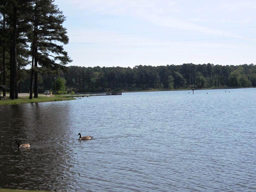
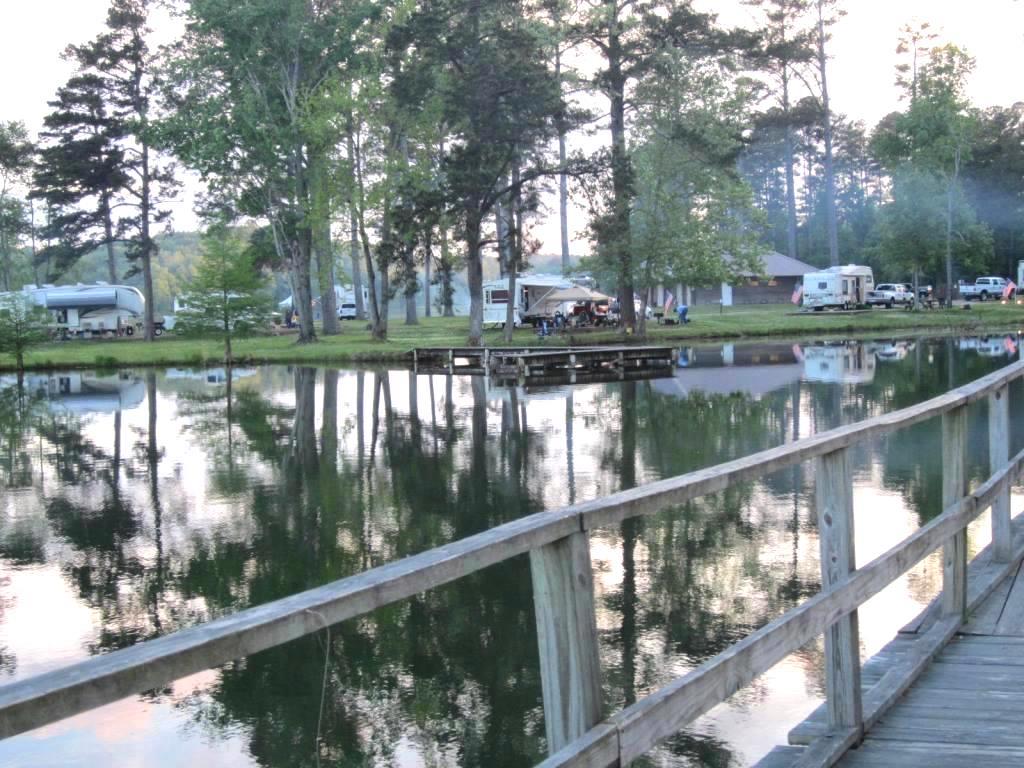
The lake is a big draw for this campground.  It is quite large and is great for boats and bank fishing.  This part of the lake and pier are in the day use portion of the park.  There are several piers and peninsulas that jut into the lake for bank fishing.  There are nice bathroom facilities in the day use area and a bathhouse in the campground.  I also noticed a washer and dryer at the bathhouse.

The camping fee here was $20 per night and uses a self-pay system.   The camp host WILL come over and see you at this campground.  Wish our stay was longer here.  It appears to be a very popular campground with locals.

We camped here Tuesday, May 7, 2013.  This campground will remain open year-round in 2013.

Natchez Trace Parkway part 5 - Tishomingo to Davis Lake

After 2 nights at Tishomingo State Park, it was time to head south to our next destination.  Davis Lake is only about 60 miles from Tishomingo down the Parkway.  

Along this route, you can see part of the Tennessee-Tombigbee Waterway, ancient burial mounds, nature trails, historical exhibits and a visitors center.

We only made one stop on this leg, at the Confederate Gravesites and Old Trace.


There is an informational plaque which states the original headstones may have had their names, but those are long since gone.  In the 1940s, a senator had marble headstones erected but they were stolen.  The National Park service erected the headstones that you see here.  There are coins and rocks left on the headstones which we wondered about while we were there.  When we got home, my husband did some googleing and found this explanation:

Supposedly, coins are left as a message to the deceased soldiers  family to let them know someone was there to pay their respects.  The denomination of coin holds some significance.  A penny just means you visited, a nickel means you trained at boot camp together, a dime means you served together, and a quarter means you were with the soldier when he or she was killed.  In the Jewish faith, it is customary to leave rocks instead of flowers.